Places in and out
A file of saved places can become notes, and the notes a Base matched can become a file again. A Base is an Obsidian file that collects the notes and files you filter for and shows them as a table or a map. Both directions stay inside your vault.
Both directions are one feature and one switch. Turn Exchange places with files off under Settings → Places in and out and a track file’s ⋮ menu offers no import and a map’s menu no export. Notes you have already imported and files you have already exported are ordinary vault files and stay as they are.
Import a file’s saved places as notes
Section titled “Import a file’s saved places as notes”Right-click a .kml, .gpx, or .geojson file — in the file explorer, or from
a note’s ⋮ menu — and choose Import places as notes…. On a phone, long press
opens that menu in the file explorer. The ⋮ menu is where it is.
The dialog says how many places the file holds, shows the first few names, and asks for a destination folder. It defaults to a folder named after the file, beside the file. Nothing is written until you confirm.
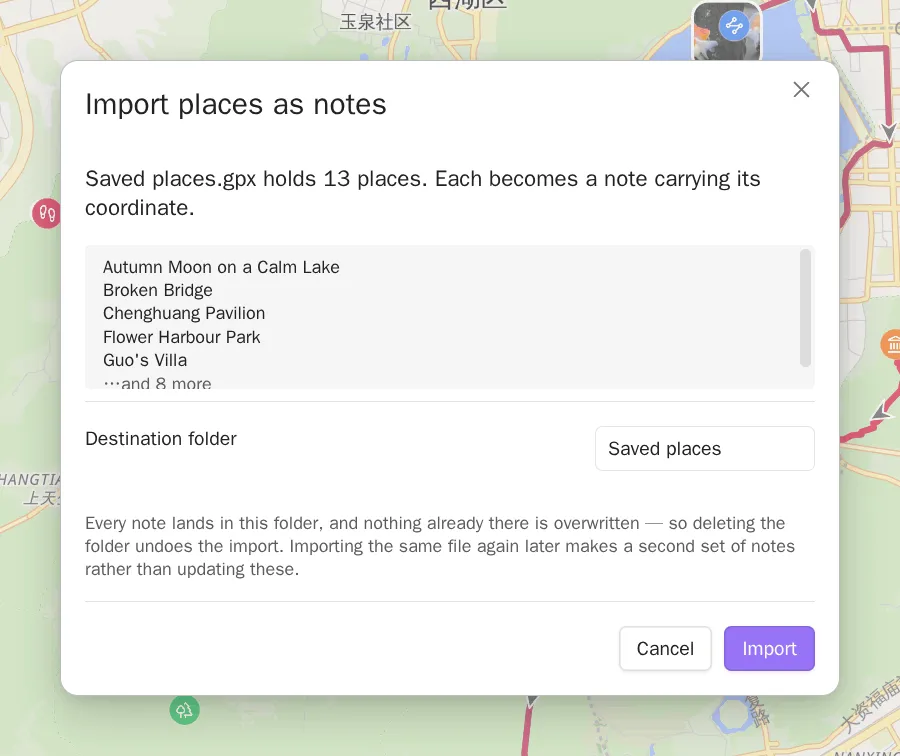
Each place becomes one note:
---coords: 31.230400,121.473700---
Go at night. Ask for the set menu.
The coordinate goes into the property named in Settings → Open in map → Coordinate property, in the same form the other commands write. That block at the top of the note is its frontmatter. The placemark’s own name becomes the note’s file name, and its description becomes the body.
The import follows these rules:
- Only points are imported. Routes and areas in the same file are left alone. They are already drawn when a note links the file.
- Nothing is overwritten. A name already taken gets a numeric suffix, so two
Homeplacemarks becomeHomeandHome 2. - Names are cleaned up. Characters a file name cannot hold become spaces. A
placemark with no name at all is named after the source file and its position
in it —
restaurants 7. - A description arrives as text. Map apps write HTML into KML descriptions. What lands in the note is the text it renders as, with its line breaks, and no markup.
- The folder is the undo. Everything the import creates goes inside it, so deleting the folder undoes the import.
- It is a snapshot, not a sync. Importing the same file again later makes a second set of notes rather than updating the first.
The notes are ordinary notes from that moment on. To see them on a map, point a Base at the folder — see Getting started for the shortest Base that does that.
Export the places a Base map shows
Section titled “Export the places a Base map shows”Right-click the map itself — long press it on a phone — and choose Export places….
What gets exported is exactly what the map shows: the rows your Base matched whose coordinate resolved. A Base matching 16,000 notes of which 300 have a coordinate exports 300 places.
| Format | Holds | For |
|---|---|---|
| GPX | Waypoints | Watches, GaiaGPS, trail apps |
| KML | Placemarks | Google My Maps, Google Earth |
| CSV | One row per place, header | Spreadsheets, anything that reads a table |
Name each place by decides what the exported name is. It defaults to the
note’s file name, and offers every property your Base displays — useful when your
notes are named 20250405162700 and the place name lives in a property. Where
the property is empty for a note, that place keeps its file name, so no place is
exported nameless.
Save as is a path inside your vault. A folder that is not there yet is created. A path that is already taken blocks the export rather than overwriting the file there, and the written path is reported when it is done.
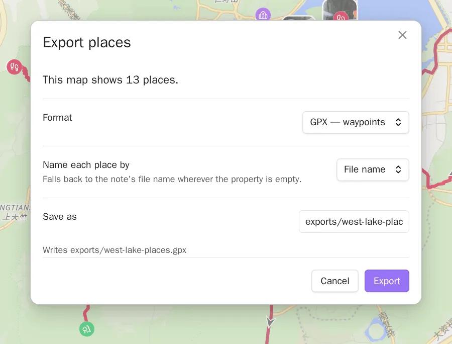
The CSV also carries each place’s note path, so a spreadsheet can lead back to the note. GPX and KML carry the name and the coordinate.
Two things follow from the file landing in your vault:
- You can sync it, share it, or open it in any app the way you would any other vault file.
- A
.gpxor.kmlin your vault is also a file the map reads. If a note links it, it is drawn. Export somewhere your Base does not match if you would rather it were not.
The file holds the coordinates your notes hold
Section titled “The file holds the coordinates your notes hold”An export writes the coordinates your notes hold. On a GCJ-02 or BD-09 basemap — the coordinate system Chinese map providers publish — the markers are shifted about 500 m so they line up with the tiles. That shift stays on the map and never reaches the file. The same Base exported over Amap and over OpenStreetMap gives identical files.
The same is true on the way in: a coordinate read from a file is written to the note unchanged. A track file is WGS-84, the coordinate system your notes use, and no map took part in reading it. See Coordinates and services for what the coordinate system setting does and does not touch.